
Street Mapping
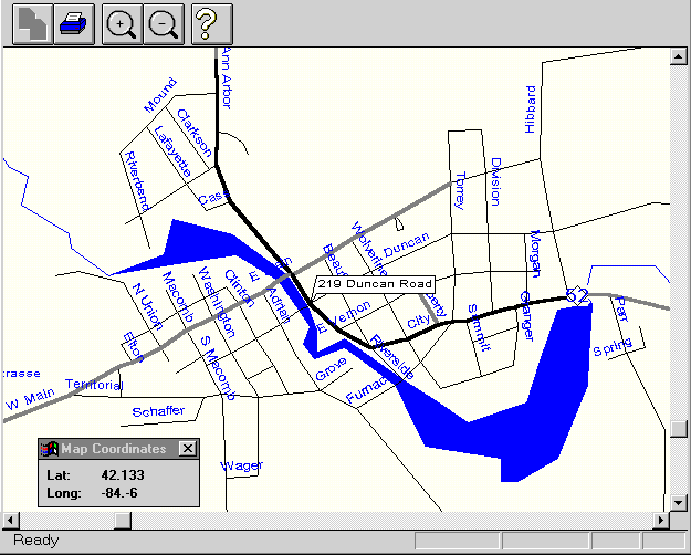
This application was developed as a prototype for prospective investment partnerts in a street-mapping / city-guide project. The maps are derived from U.S. Census Burea TIGER map data (the original source data for all U.S. street-mapping products. This application includes standard street-mapping functions: multiple-zoom levels, adaptive street and label drawing, display of water and other features, street address lookup, etc.
Street mapping presents a number of programming challenges which were solved in this project:
- Pre-processing of map database to facilitate real-time selection and display of map segments for a given location, window-size, and zoom.
- Rapid street address database search.
- Zoom-level dependent rendering of streets, labels and other map features